Photo from: Adobe Stock
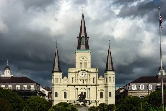
Since I’m new to NOLA, I’ve been digging into the weather patterns for the area so I can become a better forecaster. I have talked with people and they have told me about the storms that randomly happen in the summer.
These are pop up storms, and they are some of the hardest storms to forecast. A lot of why has to do with something called the cap.
What a pop up storm is
Most thunderstorms you hear about are organized. They are tied to a cold front, a squall line, or a low pressure system. They have structure, they move, and you can usually see them coming.
Pop up storms are different. They are not riding on a front. They form on their own in place, fueled by the heat and moisture of a summer afternoon. They pop up, rain themselves out, and fall apart. This usually all happens within an hour or two. Sometimes you will hear them called air mass thunderstorms because the air mass itself is basically the only ingredient driving them. I’ve heard that down here they happen almost daily in July and August.
Warm wet air wants to rise
Storms run on warm moist air rising. The sun heats the ground, the ground heats the air right above it, and that warm air is less dense than the cooler air above it. So it wants to rise like a hot air balloon. As it rises, the moisture in it condenses into cloud droplets, and that is where the puffy cumulus clouds in the morning come from.
If that rising air can keep going up, those clouds keep growing taller until you get a full thunderstorm. The problem is the air does not always get to keep going up. Sometimes the atmosphere has a layer in it that shuts everything down.
That layer is the cap.
What the cap is
The cap is a layer of warmer, drier air sitting a few thousand feet above the ground. The fancier name for it is a capping inversion. The word inversion just means the temperature is doing the opposite of what it usually does. Normally air gets cooler as you go up. In an inversion, you hit a layer where the air actually gets warmer with height.
For a rising parcel of warm wet air from the surface, that warmer layer is basically a wall. The parcel was less dense than the air around it down low, which is why it was rising in the first place. But when it bumps into the cap, the air above it is suddenly warmer than it is. The parcel cannot push through. It just spreads out underneath and stops.
Occasionally you can actually see this happening. You will look up at a sky full of cumulus clouds and notice they are all the same height with flat tops, like somebody put a ceiling on them. That ceiling is the cap.
Why we get them down here
Along the Gulf Coast in summer, caps show up a lot. The main reason is air sinking from above.
Big ridges of high pressure park themselves over the southern US in the summer. Inside a ridge, air slowly sinks. As that air sinks, it warms up. By the time it gets down to a few thousand feet above the ground, it can be noticeably warmer and drier than the muggy air sitting at the surface. That warm dry layer is the cap.
So you end up with hot wet air at the surface and a warm dry lid a few thousand feet up.
Why the cap cuts both ways
The cap is one of those things that can make or break a summer forecast.
When the cap is strong, nothing happens. You can have a sky full of moisture and a surface temperature in the mid 90s and not a single storm goes up all day. Flat topped cumulus and not a single rumble of thunder. The cap is doing its job.
When the cap is weak or gone, storms go up everywhere and rain themselves out fast. Scattered downpours all over the metro, but usually nothing too crazy.
The interesting days are the ones in between. The cap is strong but not strong enough. It holds back the storms for hours while the surface keeps heating up and the atmosphere keeps loading up with energy. Then late in the afternoon something finally punches through. And when it does, all that bottled up energy goes up at once.
That is when a regular pop up storm can turn stronger than expected. Heavy rain, gusty winds, frequent lightning, and sometimes even severe wind or hail if the setup is right. All from one storm that finally broke through after sitting under the lid all afternoon.
What breaks the cap
Surface heating is the most common one. The longer the sun bakes the ground, the warmer the surface air gets. Warmer air rises faster, which gives it more momentum when it slams into the cap. By mid to late afternoon the surface has had hours to heat up, and that is usually when the cap breaks if it is going to.
Convergence is another big one. When the Gulf sea breeze and the Lake Pontchartrain lake breeze run into each other, air piles up and gets forced upward. That extra lift can be enough to push a parcel through the cap when nothing else would.
A weak boundary moving through can do it too. An outflow boundary from a storm that fired up somewhere else, or a leftover front draped across the area, or even a subtle wind shift can give parcels the kick they need.
Why this is hard to forecast
The cap is really sensitive. A cap that is half a degree too warm holds. A cap that is half a degree too cool breaks. Models try to figure out whether the cap will hold all day, break in the morning, or sit right at that edge where it holds for hours and then suddenly fails.
That edge is where the worst storms happen. And the models are not great at it.
You can have a forecast for scattered storms and end up with a completely dry day because the cap never broke. Or you can have a forecast for an isolated shower and end up with a metro wide severe storm because the cap finally let go at 5, and 8 hours of pent up energy went up all at once.
That is why summer forecasts here often say something like "isolated to scattered storms possible." That is not the forecaster being lazy. That is the forecaster telling you the cap might hold, might break, and probably will not break evenly across the area.
The weather down here has been challenging to forecast for me. There have been days where I was certain it was going to rain and it was dry all day. It’s a learning process and I enjoy it.
I look forward to the challenge of pop up storms this summer and will do my best to forecast them for you.
💬 Comments