Image from: Wikimedia Commons
We are starting to feel it. We can ditch the winter coats and enjoy the days. But with this we are also finding ourselves glued to the radar.
So what is happening in the atmosphere in the spring?
The Atmosphere Is in Transition
When spring hits on the calendar, winter doesn’t just disappear. You still have cold, dry air hanging around to the north while warm, moist air starts pushing north from the Gulf.
That temperature contrast helps create boundaries and instability, which can set the stage for storms to develop.
The Jet Stream is Still Doing Its Thing
In the spring, the jet stream is still strong and positioned across the midlatitudes. In the summer, it often weakens and shifts farther north.
This helps create wind shear. If surface winds and winds aloft are doing two different things, either moving faster with height or blowing from different directions, that helps storms organize.
Instead of collapsing on themselves, they can sustain their updrafts. Essentially without shear a storm suffocates, shear tilts a storm and lets it breathe. Potentially staying alive for hours.
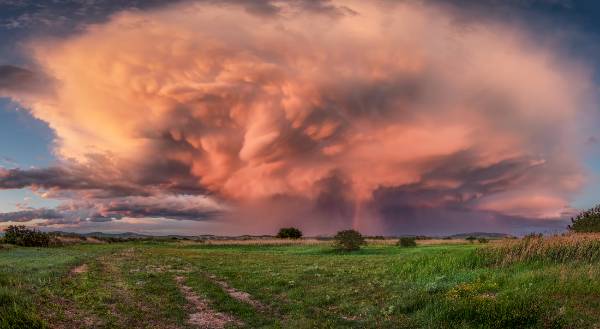
Strong wind shear helps supercells form instead of just random thunderstorms.
Moisture Comes Back Into Play
Winter usually shuts off that deep moisture, especially from the Gulf of Mexico.
In the spring, that switch flips.
Dewpoints start increasing. With more humidity, you get more energy available for storms. You may have heard the term “CAPE”, this is the gas for storms. The higher the CAPE, the more the storm has to work with.
So when there is little to no moisture, it is much harder to get strong storms.
When that moisture comes back, the atmosphere has the fuel it needs to develop them.
There’s No Shortage of Triggers
Spring has plenty of options to get storms brewing when there is instability in the atmosphere.
There are cold fronts, warm fronts, low pressure systems, and drylines. There’s usually something moving through or setting up. These features act as the trigger that forces air upward and gets storms started.
And once they start, the environment is often already supportive of severe weather.
Why Not Summer?
Summer can have extreme heat and humidity, so you’d think it would be peak severe weather season. But a lot of the time, storms in summer don’t organize as well.
The answer is shear. By summer, the jet stream has often weakened and shifted north, so while you still have instability, you lose a lot of the wind structure that helps storms stay organized and rotate.
In the spring you often have both instability and wind shear, and that combination can make all the difference.
Putting It All Together
So spring is really just the “perfect storm” for severe weather.
There’s clashing air masses creating instability, the jet stream providing shear, moisture returning from the Gulf, and an abundance of systems to trigger storms.
Alone, none of these are enough. But when they all come together, severe weather starts brewing.
Final Thought
So spring isn’t just “storm season” by chance, it’s when the atmosphere is most out of balance, and the more out of balance things are, the more energy there is to work with.
That’s why once you start paying attention to patterns, warm air surging north, a trough moving in, winds increasing aloft, you can almost feel when the setup is there before anything even shows up on radar.
💬 Comments